
What Is SLAM Scanning?
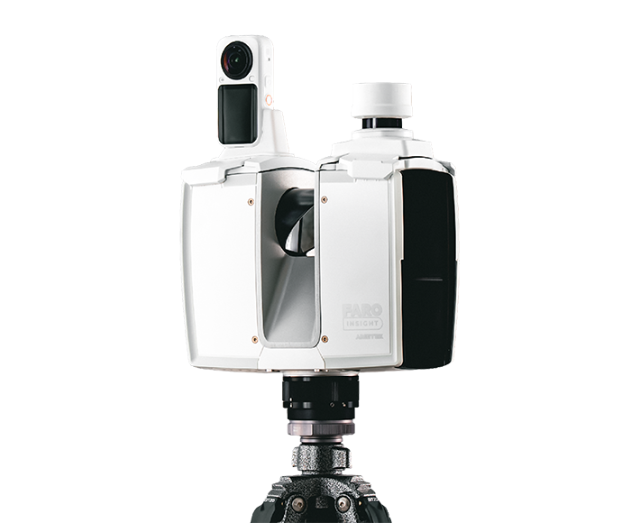
SLAM scanning is a mobile 3D laser scanning technology that captures accurate spatial data while the scanner moves through a building, construction site, infrastructure project, or industrial facility.
SLAM stands for Simultaneous Localization and Mapping. Unlike traditional terrestrial laser scanning, which generally relies on setting up a scanner at multiple fixed positions, a SLAM scanner can be carried or mounted on a mobile platform while continuously mapping the surrounding environment.
The result is a 3D point cloud that represents the existing physical environment.
For construction and engineering teams, SLAM scanning can provide a faster way to capture existing conditions, particularly in large, complex or difficult-to-access spaces.
How Does SLAM Scanning Work?
A SLAM scanning system typically combines several technologies, including:
- LiDAR sensors
- Inertial Measurement Units (IMUs)
- Cameras or visual sensors
- Processing algorithms
- SLAM algorithms
As the operator moves through a site, the LiDAR sensor continuously measures surrounding surfaces.
At the same time, the SLAM algorithm determines the scanner’s position and builds a map of the environment.
In simple terms:
Scanner moves ? LiDAR captures surroundings ? SLAM calculates position ? Data is registered ? 3D point cloud is created
This allows large areas to be captured without relying entirely on traditional surveying control points.
SLAM Scanning vs Traditional Laser Scanning
Both technologies capture 3D spatial information, but their workflows are different.
| Factor | SLAM Scanning | Terrestrial Laser Scanning |
| Scanner movement | Mobile | Fixed positions |
| Setup time | Generally low | Higher |
| Data capture speed | Fast | Moderate |
| Large indoor areas | Excellent | Excellent |
| Complex environments | Excellent | Excellent |
| Maximum accuracy | Typically lower | Typically higher |
| Detailed BIM capture | Suitable depending on requirements | Excellent |
| Operator mobility | Very high | Moderate |
| Best application | Rapid reality capture | High-precision documentation |
The right technology depends on the required accuracy, project size, environment, deliverables and application.
For projects requiring extremely high precision or detailed component-level documentation, a static terrestrial laser scanning workflow may be more appropriate.
For rapid capture of large spaces, SLAM can provide significant productivity advantages.
What Accuracy Can SLAM Scanning Achieve?
Accuracy varies considerably depending on:
- Scanner hardware
- SLAM algorithm
- Environmental conditions
- Scan trajectory
- Loop closures
- Distance travelled
- Surface characteristics
- Registration workflow
- Project requirements
Therefore, it is not appropriate to treat “SLAM accuracy” as a single universal number.
For many building documentation, construction and facility-management applications, the achievable accuracy can be sufficient for the required deliverable.
However, projects requiring highly precise dimensional control should establish the required tolerance before scanning begins.
A professional scanning provider should therefore discuss:
Required accuracy ? scanning technology ? control methodology ? deliverables
before starting the project.
Why Use SLAM Scanning?
1. Faster Data Capture
One of the biggest advantages of SLAM scanning is speed.
An operator can move through a building or site while continuously capturing spatial information.
This can significantly reduce the amount of time required for field data collection compared with setting up a static scanner at numerous locations.
2. Minimal Setup
Traditional terrestrial scanning often requires the operator to:
- Position the scanner
- Level and configure it
- Capture the scan
- Move the equipment
- Establish another scanning position
- Register the resulting scans
SLAM scanning simplifies the field workflow because the scanner can continuously collect data while moving through the environment.
3. Excellent for Complex Spaces
SLAM is particularly useful in environments such as:
- Industrial facilities
- Warehouses
- Commercial buildings
- Hospitals
- Construction sites
- MEP spaces
- Plant rooms
- Infrastructure facilities
- Large interiors
The operator can move through corridors, rooms, staircases and interconnected areas while capturing the surrounding geometry.
Applications of SLAM Scanning
1. Construction
SLAM scanning can help construction teams document existing conditions quickly.
Potential applications include:
- Existing-condition surveys
- Construction verification
- Progress documentation
- Renovation projects
- As-built documentation
- Site measurements
- Spatial coordination
- Quality control
The resulting point cloud can then support downstream CAD and BIM workflows.
2. Scan-to-BIM
SLAM scanning can provide the reality-capture data required for Scan-to-BIM workflows.
A typical workflow is:
SLAM Scan
?
Point Cloud
?
Point Cloud Processing
?
Model Development
?
BIM Model
?
Design / Coordination / Facility Management
Depending on the project requirements, the resulting model may contain architectural, structural or MEP information.
The level of detail should be defined before scanning and modeling begins.
3. MEP Documentation
Mechanical, electrical and plumbing systems can be difficult to document manually, particularly in existing buildings.
SLAM scanning can capture:
- Pipes
- Ducts
- Cable trays
- Equipment
- Plant rooms
- Mechanical spaces
- Electrical rooms
The captured data can help engineering teams understand existing conditions before renovation or retrofit work.
4. Industrial Facilities
Industrial environments often contain complicated layouts with:
- Pipes
- Tanks
- Machinery
- Structural elements
- Platforms
- Equipment
- Cable trays
- Process systems
SLAM scanning can help create a digital representation of these environments.
This information can support:
- Plant modifications
- Retrofit planning
- Maintenance
- Asset documentation
- Engineering design
- Facility management
5. Infrastructure
SLAM technology can also be useful for certain infrastructure documentation projects.
Applications may include:
- Tunnels
- Transportation facilities
- Utility facilities
- Large public buildings
- Underground environments
- Bridges and associated structures
The suitability of SLAM depends on the required accuracy, environmental conditions and project scope.
6. As-Built Documentation
One of the most practical applications is creating documentation of existing conditions.
For renovation and retrofit projects, original drawings may be:
- Missing
- Outdated
- Inaccurate
- Incomplete
SLAM scanning can provide current spatial data that can be used to develop updated drawings and models.
This can reduce reliance on assumptions during design.
7. Facility Management
Accurate spatial information can also support facility management.
A captured point cloud can provide a digital reference for:
- Building layouts
- Equipment locations
- MEP systems
- Structural components
- Maintenance planning
- Renovation planning
When combined with BIM and other data sources, reality-capture information can contribute to more intelligent facility-management workflows.
SLAM Scanning for Existing Buildings
Existing buildings can present significant challenges for conventional measurement.
A facility may have:
- Irregular layouts
- Limited access
- Crowded MEP spaces
- Multiple floors
- Narrow corridors
- Complex equipment
- Poor documentation
SLAM scanning allows operators to move through these environments while continuously capturing spatial information.
This makes it particularly useful for brownfield projects, renovation projects and retrofit work.
SLAM Scanning Workflow
A professional SLAM scanning project typically follows several stages.
Step 1: Project Assessment
First, the scanning team determines:
- Project objectives
- Site conditions
- Required accuracy
- Area to be captured
- Required deliverables
- Coordinate requirements
Step 2: Site Preparation
The team identifies:
- Access requirements
- Safety requirements
- Survey control
- Scanning routes
- Areas requiring special attention
Step 3: Data Capture
The operator moves through the site while the scanner continuously captures LiDAR data.
Step 4: Data Processing
Raw scanning data is processed and checked.
This may include:
- Registration
- Noise removal
- Alignment
- Quality control
- Coordinate transformation
Step 5: Point Cloud Delivery
The processed data can be delivered in an appropriate format depending on the project requirements.
Step 6: CAD/BIM Development
Where required, the point cloud can be used as the basis for:
- 2D CAD drawings
- 3D models
- Revit models
- MEP models
- Architectural models
- Structural models
What Are the Deliverables from SLAM Scanning?
Deliverables depend on the project scope.
Common outputs may include:
Point Cloud
A 3D representation of the scanned environment.
2D CAD Drawings
Possible drawings include:
- Floor plans
- Elevations
- Sections
- Reflected ceiling plans
BIM Models
Depending on project requirements:
- Architectural BIM
- Structural BIM
- MEP BIM
Registered Survey Data
Data aligned to the project’s required coordinate system where applicable.
Before starting a project, clients should clearly define the expected deliverables and level of detail.
Limitations of SLAM Scanning
SLAM is powerful, but it is not the right technology for every project.
Potential limitations include:
1. Accuracy Requirements
If the project requires extremely high dimensional accuracy, conventional terrestrial laser scanning or a hybrid workflow may be preferable.
2. Long Open Spaces
Large environments with limited geometric features can present challenges for some SLAM systems.
3. Reflective Surfaces
Certain surfaces can affect LiDAR data quality.
4. Moving Objects
People, vehicles and moving equipment can introduce unwanted data.
5. Data Quality Depends on the Workflow
The final result depends not only on the scanner but also on:
- Operator experience
- Scanning route
- Processing
- Registration
- Quality control
For this reason, choosing the right technology should be based on the project requirement rather than simply choosing the newest scanning technology.
SLAM vs Total Station vs Traditional Surveying
SLAM scanning and conventional surveying serve different purposes.
Traditional surveying instruments such as total stations are excellent for establishing precise points, coordinates and control.
SLAM scanning is designed to rapidly capture dense 3D spatial information.
In many projects, the best solution may actually be a combination of technologies.
For example:
Total Station / GNSS
SLAM
Terrestrial Laser Scanning
can provide both survey control and detailed spatial documentation.
When Should You Choose SLAM Scanning?
SLAM scanning can be a strong option when you need:
- Rapid site documentation
- Large-area indoor capture
- Existing-condition data
- Renovation documentation
- Industrial facility mapping
- MEP documentation
- As-built information
- Point clouds
- Scan-to-BIM inputs
- Faster field data collection
However, the technology should always be selected based on the project’s required accuracy, environment and final deliverables.
How Much Does SLAM Scanning Cost?
There is no universal price for SLAM scanning.
Project pricing can depend on:
- Total area
- Number of floors
- Site accessibility
- Project location
- Required accuracy
- Data density
- Deliverables
- Point cloud processing
- CAD/BIM requirements
- Survey control requirements
- Project complexity
For example, a simple building documentation project and a complex industrial facility may require completely different workflows.
The best approach is to request a project-specific quotation based on the site area and required deliverables.
Why Professional SLAM Scanning Matters
Buying or renting scanning equipment is only one part of a reality-capture project.
The quality of the final output also depends on:
- Planning
- Scanning methodology
- Operator experience
- Data processing
- Registration
- Quality assurance
- Coordinate control
- CAD/BIM expertise
For engineering and construction projects, poor-quality spatial data can create downstream problems.
A professional provider should therefore deliver not just raw scan data, but a workflow aligned with the client’s engineering and documentation requirements.
SLAM Scanning and the Future of Reality Capture
The construction and infrastructure industries are increasingly moving toward reality capture.
Instead of relying entirely on manual measurements and outdated drawings, project teams can capture existing environments digitally and use the data throughout the project lifecycle.
SLAM scanning is one part of this larger ecosystem.
A modern reality-capture workflow can combine:
SLAM
? 3D Laser Scanning
? Drone LiDAR
? Photogrammetry
? Point Clouds
? CAD/BIM
? Digital Twins
This creates a connected workflow from the physical environment to a digital representation.
Conclusion
SLAM scanning is a fast and flexible reality-capture technology for documenting buildings, construction sites, infrastructure and industrial environments.
Its biggest advantages are mobility, rapid data capture and the ability to collect 3D spatial information across complex environments with relatively little setup.
However, SLAM should not automatically replace traditional surveying or terrestrial laser scanning. The right technology depends on the project’s accuracy requirements, environment, scope and deliverables.
For projects involving existing buildings, renovation, industrial facilities, MEP documentation or Scan-to-BIM, SLAM can be a valuable component of a professional reality-capture workflow.
If you are planning a project and are unsure whether SLAM scanning, terrestrial laser scanning, drone LiDAR or a hybrid approach is appropriate, a project assessment can help determine the most suitable technology.
Frequently Asked Questions
1. What does SLAM stand for in scanning?
SLAM stands for Simultaneous Localization and Mapping. It allows a mobile scanning system to determine its position while simultaneously creating a map of the surrounding environment.
2. Is SLAM scanning accurate?
SLAM accuracy depends on the equipment, environment, scanning workflow and processing methodology. It can be highly effective for many documentation applications, but projects requiring very tight tolerances may require terrestrial laser scanning or a hybrid approach.
3. Can SLAM scanning be used for Scan-to-BIM?
Yes. SLAM-generated point clouds can be used as input data for Scan-to-BIM workflows when the captured data meets the project’s required accuracy and level of detail.
4. Is SLAM better than 3D laser scanning?
Neither technology is universally better. SLAM is generally advantageous for rapid mobile capture, while static terrestrial laser scanning can provide higher precision and detailed documentation.
5. Can SLAM scan an entire building?
Yes, depending on the building size, layout and project requirements. SLAM is particularly useful for capturing large and complex indoor environments.
6. What files can be delivered after SLAM scanning?
Depending on the project, deliverables can include point clouds, CAD drawings, BIM models and registered survey data.
Suggested internal links for VBTI Terrascan
Within this article, I would naturally link to:
3D Laser Scanning Services
Scan-to-BIM Services
Point Cloud to BIM
As-Built Documentation
Drone LiDAR / Photogrammetry
Digital Twin Services