Introduction
Surveying large construction sites, infrastructure corridors, mines and industrial properties can be challenging with conventional ground-based methods.
Large areas may contain:
- Uneven terrain
- Dense vegetation
- Stockpiles
- Slopes
- Construction activity
- Difficult-to-access areas
- Existing structures
- Large elevation changes
Collecting detailed survey information across these environments can require significant time and manpower.
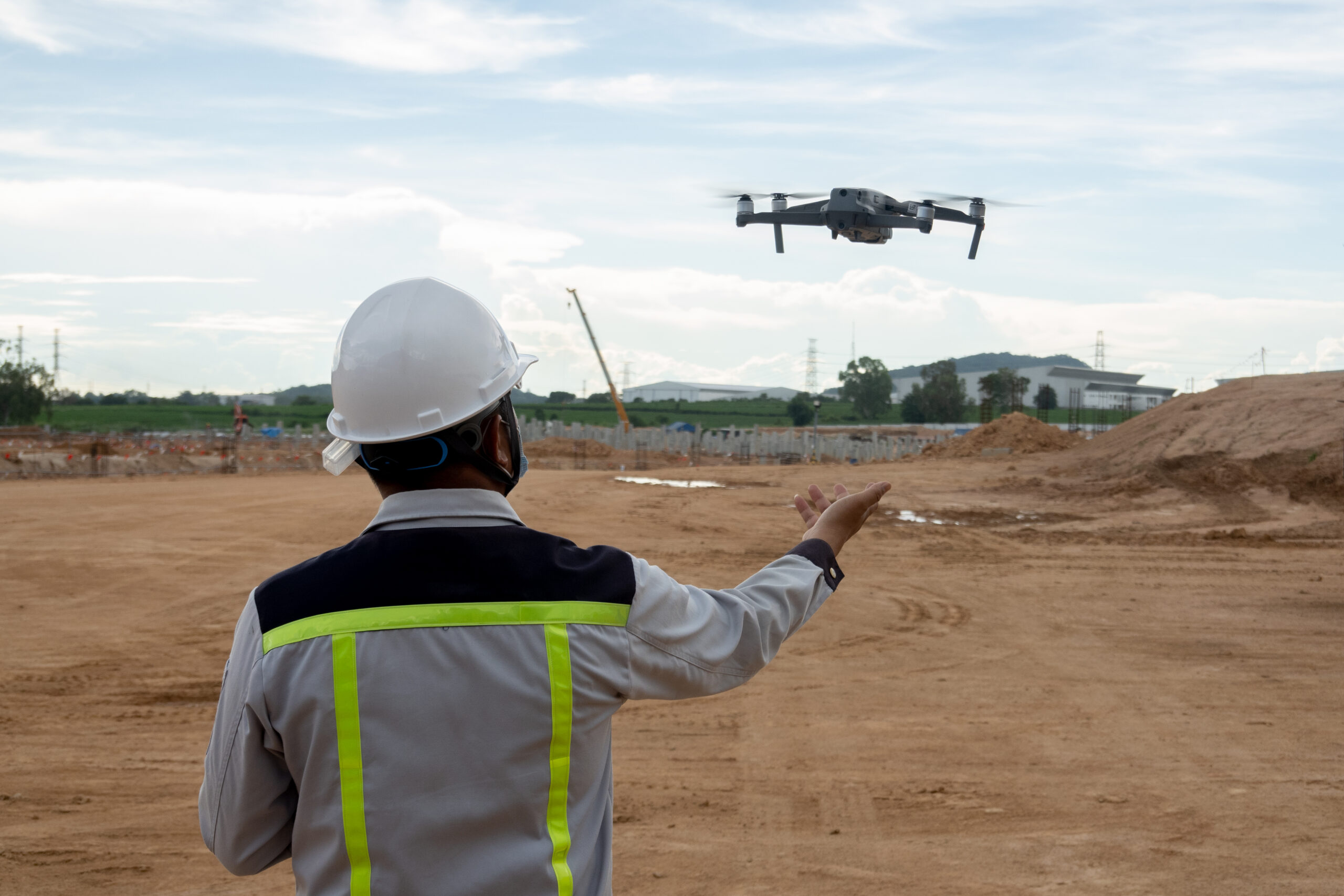
Drone LiDAR surveying provides an alternative approach by combining an unmanned aerial vehicle with a LiDAR sensor to capture three-dimensional information from above.
The resulting data can be processed into point clouds, terrain models, elevation data and other geospatial deliverables.
But how accurate is drone LiDAR? Where is it useful? How much does it cost? And when should you choose drone LiDAR instead of photogrammetry or conventional surveying?
This guide explains everything you need to know.
What Is Drone LiDAR Surveying?
Drone LiDAR surveying uses a LiDAR sensor mounted on a drone to measure distances between the sensor and surfaces below it.
LiDAR stands for Light Detection and Ranging.
The sensor emits laser pulses toward the ground. These pulses reflect from surfaces and return to the sensor.
By measuring the travel time of the laser pulses, the system can calculate distances.
Combined with positioning and orientation data, the system can generate a detailed three-dimensional representation of the surveyed area.
The basic workflow is:
Drone
?
LiDAR Sensor
?
Laser Pulses
?
Surface Measurements
?
Georeferenced Point Cloud
?
Terrain / 3D Data
?
Survey Deliverables
How Does Drone LiDAR Work?
A professional drone LiDAR system typically combines:
- LiDAR sensor
- GNSS positioning
- Inertial Measurement Unit (IMU)
- Drone platform
- Data storage
- Processing software
During the flight, the drone follows a predefined survey path.
The LiDAR sensor continuously captures measurements while the positioning system records the drone’s location and orientation.
After the flight, the collected information is processed to create a georeferenced point cloud.
What Is a LiDAR Point Cloud?
A point cloud is a collection of millions of individual 3D points representing surfaces captured during the survey.
Each point can contain information such as:
- X coordinate
- Y coordinate
- Z/elevation
- Intensity
- Classification
- RGB/color information, depending on the system and workflow
A point cloud may represent:
- Ground
- Buildings
- Trees
- Roads
- Infrastructure
- Stockpiles
- Equipment
- Terrain
The data can then be classified and converted into other survey products.
What Are the Main Deliverables?
Depending on project requirements, drone LiDAR surveys can produce:
1. Classified Point Cloud
A 3D dataset containing classified points.
2. Digital Terrain Model (DTM)
Represents the underlying terrain surface.
3. Digital Surface Model (DSM)
Represents the elevation of the visible surface, including buildings and vegetation.
4. Contour Maps
Useful for:
- Site planning
- Engineering
- Drainage analysis
- Earthwork planning
5. Elevation Data
Useful for understanding terrain and site gradients.
6. 3D Models
Depending on the workflow, 3D representations of the site can be developed.
7. Orthophotos
If LiDAR is combined with drone imagery, orthomosaic imagery can also be generated.
The exact deliverables should always be defined before the survey begins.
Why Use Drone LiDAR for Large Sites?
1. Efficient Large-Area Coverage
One of the biggest advantages of drone LiDAR is its ability to collect data across large areas efficiently.
Instead of relying entirely on teams walking across a site, the drone can capture data from above.
This can be particularly valuable for:
- Large construction developments
- Mines
- Quarries
- Roads
- Rail corridors
- Industrial sites
- Infrastructure projects
2. Access Difficult Areas
Some areas are difficult or unsafe for survey teams to access.
Examples include:
- Steep slopes
- Cliffs
- Stockpiles
- Construction zones
- Rough terrain
- Restricted areas
Drone LiDAR can capture information without requiring personnel to physically access every part of the site.
However, drone operations must still comply with applicable aviation regulations and site safety requirements.
3. Useful in Vegetated Areas
One of the major advantages of LiDAR over purely image-based methods is that some LiDAR pulses can penetrate gaps in vegetation and reach the ground.
This can make LiDAR particularly useful for certain terrain-mapping applications involving:
- Forested areas
- Vegetated sites
- Overgrown land
- Infrastructure corridors
The amount of vegetation penetration depends on factors including vegetation density, sensor characteristics, flight altitude and point density.
4. Detailed Terrain Information
Drone LiDAR can generate dense elevation information across a site.
This can help engineers and planners understand:
- Slopes
- Elevation changes
- Drainage patterns
- Cut-and-fill areas
- Terrain profiles
- Earthwork requirements
Drone LiDAR Applications
1. Construction Site Surveying
Drone LiDAR can support construction projects from early planning through progress monitoring.
Potential applications include:
- Existing-condition surveys
- Topographic mapping
- Construction progress
- Earthwork measurement
- Cut-and-fill analysis
- Site planning
- Volume calculations
Repeated surveys can also help teams compare site conditions over time.
2. Mining and Quarry Surveys
Mining operations can contain large and constantly changing surfaces.
Drone LiDAR can be used for:
- Stockpile measurement
- Terrain mapping
- Pit surveys
- Slope analysis
- Volume calculations
- Site monitoring
- Mine planning
For large sites, aerial data collection can be significantly more efficient than relying entirely on ground-based measurements.
3. Infrastructure
Drone LiDAR can support infrastructure projects involving:
- Roads
- Railways
- Bridges
- Airports
- Utility corridors
- Transmission corridors
- Large public infrastructure
The ability to capture long corridors and difficult terrain makes aerial LiDAR particularly useful for some infrastructure projects.
4. Topographic Surveying
Topographic surveys provide information about the shape and elevation of land.
Drone LiDAR can help create:
- Contours
- Elevation models
- Terrain profiles
- Surface models
- 3D terrain datasets
This information can support engineering and planning.
5. Stockpile Volume Measurement
Stockpile measurement is another useful application.
For example:
Survey ? Point Cloud ? Surface Model ? Volume Calculation
This can be used for:
- Aggregate stockpiles
- Soil
- Sand
- Coal
- Construction materials
- Mining materials
Repeated surveys can help organizations track changes in stockpile volumes over time.
6. Corridor Mapping
Long infrastructure corridors can be difficult to survey using only ground-based methods.
Drone LiDAR can support mapping of:
- Roads
- Railways
- Pipelines
- Power corridors
- Canals
- Utility routes
The exact suitability depends on corridor width, terrain, vegetation, regulatory restrictions and required accuracy.
7. Industrial Sites
Industrial sites can benefit from aerial mapping when large outdoor areas need to be documented.
Applications can include:
- Site mapping
- Terrain documentation
- Asset context
- Expansion planning
- Infrastructure mapping
- Construction monitoring
Drone LiDAR can complement terrestrial laser scanning when detailed indoor or close-range geometry is also required.
How Accurate Is Drone LiDAR?
Accuracy is one of the most important considerations when selecting a drone LiDAR solution.
However, there is no single accuracy value that applies to every drone LiDAR survey.
Accuracy depends on:
- LiDAR sensor
- GNSS quality
- IMU performance
- Flight altitude
- Ground control
- Check points
- Terrain
- Vegetation
- Flight planning
- Point density
- Processing methodology
- Calibration
- Survey conditions
A professional survey should therefore specify the expected accuracy and validation methodology rather than simply advertising a generic accuracy number.
Drone LiDAR vs Drone Photogrammetry
Drone LiDAR and photogrammetry are often considered alternatives, but they work differently.
Drone LiDAR
Uses:
Laser pulses
Photogrammetry
Uses:
Photographs
Here’s a simplified comparison:
| Factor | Drone LiDAR | Drone Photogrammetry |
| Data source | Laser | Images |
| Terrain mapping | Excellent | Excellent |
| Vegetation | Often advantageous | Can be challenging |
| Texture/color | Limited unless imagery is integrated | Excellent |
| Large-area mapping | Excellent | Excellent |
| Elevation data | Excellent | Excellent |
| 3D models | Yes | Yes |
| Orthomosaic | Requires imagery | Excellent |
| Processing | High | High |
| Dense vegetation | Often advantageous | More challenging |
| Visual detail | Lower | Excellent |
Neither technology is universally better.
The right choice depends on the project’s objectives.
Drone LiDAR vs Traditional Surveying
Traditional surveying remains extremely valuable for high-precision control and detailed measurements.
Drone LiDAR offers different advantages.
Traditional Surveying
Excellent for:
- Control points
- Precise measurements
- Detailed site verification
- Boundary work
- Specific engineering points
Drone LiDAR
Excellent for:
- Large-area coverage
- Terrain mapping
- Difficult terrain
- Rapid data acquisition
- Dense spatial datasets
In many projects, the best solution is a combination.
For example:
GNSS / Total Station Control
Drone LiDAR
?
Validated Geospatial Dataset
This combines aerial coverage with survey control.
Drone LiDAR + Photogrammetry
Another powerful approach is combining LiDAR with drone imagery.
LiDAR provides:
- Elevation
- Geometry
- Terrain information
- Point cloud
Photogrammetry provides:
- High-resolution imagery
- Color
- Texture
- Orthomosaics
Together, they can create a more comprehensive representation of a site.
This hybrid approach can be particularly useful for:
- Infrastructure
- Construction
- Mining
- Large industrial sites
- Environmental surveys
Drone LiDAR Survey Workflow
Step 1: Project Planning
The survey team defines:
- Survey boundary
- Required accuracy
- Deliverables
- Flight restrictions
- Ground conditions
- Coordinate system
Step 2: Site Assessment
The team evaluates:
- Terrain
- Vegetation
- Buildings
- Obstacles
- Airspace
- Access
- Safety requirements
Step 3: Ground Control / Check Points
Where required, survey control and independent check points are established.
These can help validate the resulting dataset.
Step 4: Flight Planning
The flight path is designed based on:
- Survey area
- Required point density
- Terrain
- Sensor specifications
- Flight altitude
- Overlap
- Regulatory constraints
Step 5: LiDAR Data Acquisition
The drone flies the planned survey mission while the LiDAR sensor continuously captures measurements.
Step 6: Data Processing
The collected data is processed and georeferenced.
Typical steps can include:
- Trajectory processing
- Point-cloud generation
- Noise filtering
- Registration
- Classification
- Coordinate transformation
- Quality control
Step 7: Deliverable Creation
Depending on the project, the final outputs can include:
- Point cloud
- DTM
- DSM
- Contours
- Elevation maps
- 3D models
- Volume calculations
- CAD/GIS datasets
How Much Does a Drone LiDAR Survey Cost?
There isn’t a standard price for drone LiDAR surveying.
Pricing depends on:
Survey Area
A small site and a large mining operation require very different resources.
Terrain
Complex terrain can increase planning and processing requirements.
Accuracy
Higher accuracy requirements may require additional control and quality assurance.
Deliverables
A raw point cloud is different from a fully classified dataset with:
- DTM
- DSM
- Contours
- CAD
- GIS
- Volume calculations
Site Location
Travel, permits and logistics can influence project costs.
Vegetation
Dense vegetation may require different flight and processing strategies.
Regulatory Requirements
Drone operations may require specific permissions or operational constraints depending on the location.
Therefore, project-based pricing is generally more appropriate than a simple per-acre rate.
Factors That Affect Drone LiDAR Survey Cost
Before requesting a quotation, provide:
- Site location
- Approximate area
- Site map
- Required accuracy
- Required deliverables
- Expected survey date
- Terrain description
- Vegetation conditions
- Coordinate system
- Whether CAD/BIM is required
This allows the survey provider to estimate the project more accurately.
Benefits of Drone LiDAR for Large Sites
Faster Data Collection
Large areas can be captured efficiently.
High-Density 3D Data
LiDAR can generate detailed spatial datasets.
Difficult Terrain
Aerial capture reduces the need for surveyors to physically traverse every area.
Repeatable Surveys
Regular flights can support monitoring over time.
Detailed Elevation Information
Useful for engineering and planning.
Integration with Other Technologies
Drone LiDAR can be combined with:
- GNSS
- Total Stations
- Photogrammetry
- Terrestrial Laser Scanning
- SLAM
- BIM
- GIS
Limitations of Drone LiDAR
Despite its advantages, drone LiDAR has limitations.
Weather
Wind, rain and other environmental conditions can affect flight operations and data collection.
Airspace Restrictions
Drone operations must comply with applicable aviation regulations.
Vegetation
LiDAR can sometimes capture ground beneath vegetation, but dense vegetation can still make ground classification difficult.
High Initial Equipment Cost
Professional LiDAR-equipped drones require specialized equipment and expertise.
Data Processing
Large point clouds can require substantial processing and storage resources.
Not Suitable for Every Environment
Indoor spaces and extremely detailed close-range documentation may be better suited to terrestrial or mobile scanning.
When Should You Choose Drone LiDAR?
Drone LiDAR is worth considering when you need:
- Large-area terrain mapping
- High-density elevation data
- Difficult-to-access site documentation
- Mining and quarry surveys
- Infrastructure corridor mapping
- Construction site surveys
- Stockpile measurements
- Vegetated terrain mapping
- Repeated site monitoring
- Large-scale 3D datasets
When Should You Use a Different Technology?
Choose Terrestrial Laser Scanning when:
You need highly detailed documentation of:
- Buildings
- Interiors
- MEP
- Industrial equipment
- Complex structures
Choose SLAM when:
You need rapid mobile capture of:
- Buildings
- Interiors
- Facilities
- Complex spaces
Choose Photogrammetry when:
You need:
- High-resolution imagery
- Orthomosaics
- Textured 3D models
- Large-area visual documentation
Choose GPR when:
You need to investigate:
- Underground utilities
- Subsurface anomalies
- Concrete reinforcement
- Embedded services
Choose a Hybrid Workflow when:
Your project requires multiple types of reality-capture data.
Drone LiDAR and BIM
Drone LiDAR can contribute to BIM and digital construction workflows, particularly for large sites.
A possible workflow is:
Drone LiDAR
?
Point Cloud
?
Terrain / Site Model
?
CAD / BIM
?
Construction Planning
For projects requiring detailed building interiors, drone LiDAR can be combined with terrestrial laser scanning or SLAM.
This creates a more comprehensive reality-capture workflow.
Drone LiDAR and Digital Twins
Drone LiDAR can also contribute to digital twin development.
For large infrastructure or industrial sites:
Drone LiDAR
Terrestrial Scanning
BIM
Asset Data
?
Digital Twin
This can provide a digital representation of the physical environment for planning, monitoring and asset management.
How to Choose a Drone LiDAR Survey Company
Before hiring a provider, ask:
- What LiDAR equipment do you use?
- What accuracy can you realistically achieve?
- How do you validate accuracy?
- Do you use ground control and check points?
- What point density can you provide?
- Can you map difficult terrain?
- Can you provide classified point clouds?
- Do you provide DTM and DSM?
- Can you provide CAD/GIS outputs?
- Can you combine LiDAR with photogrammetry?
- Can you integrate the data with BIM?
- What aviation permissions are required?
- What quality-control process do you follow?
- What is included in the final deliverables?
The objective should be to select a provider based on survey methodology and deliverable quality, not simply the lowest quotation.
Frequently Asked Questions
What is a drone LiDAR survey?
A drone LiDAR survey uses a LiDAR sensor mounted on an unmanned aircraft to capture three-dimensional information about terrain, structures and other surfaces.
Is drone LiDAR accurate?
Drone LiDAR can provide highly accurate geospatial data, but actual accuracy depends on the equipment, flight planning, GNSS/IMU performance, control, terrain, processing and quality assurance.
How much area can a drone LiDAR survey cover?
Coverage depends on the drone, sensor, flight conditions, required point density, terrain and regulatory limitations. Large sites can often be surveyed efficiently using planned aerial missions.
Can drone LiDAR penetrate vegetation?
Some LiDAR pulses can pass through gaps in vegetation and reach the ground, which can make LiDAR advantageous for certain vegetated environments. Results depend heavily on vegetation density and sensor characteristics.
Is drone LiDAR better than photogrammetry?
Not universally. Drone LiDAR is particularly strong for elevation and terrain information, while photogrammetry provides excellent visual information, imagery and textured models.
Can drone LiDAR create a point cloud?
Yes. A primary output of a drone LiDAR survey is a georeferenced 3D point cloud.
Can drone LiDAR be used for construction?
Yes. Potential applications include topographic surveys, construction monitoring, earthwork measurement, site mapping and planning.
Can drone LiDAR be used for mining?
Yes. It can support terrain mapping, stockpile measurements, pit surveys, volume calculations and site monitoring.
Can drone LiDAR data be used in BIM?
Yes. Depending on the project requirements, LiDAR point clouds and terrain data can support CAD, BIM and digital construction workflows.
Conclusion
Drone LiDAR surveying provides an efficient way to capture detailed three-dimensional information across large, complex and difficult-to-access sites.
Its applications range from construction and mining to infrastructure, topographic surveying, industrial facilities and stockpile measurement.
The technology is particularly valuable when large-area coverage, elevation information and dense spatial data are required.
However, the best reality-capture solution depends on the project.
For some projects, drone LiDAR may be the ideal technology. For others, photogrammetry, terrestrial laser scanning, SLAM, GPR or a hybrid approach may provide better results.
The right decision should be based on:
Project Scale + Required Accuracy + Environment + Deliverables + Budget
rather than technology alone.